Drone Imaging
Specialists
CASA Certified - Safety First !
Aerial
Inspections
Using the latest drone technology.
Real Estate
Developments
Assess progress from
site works to completion.
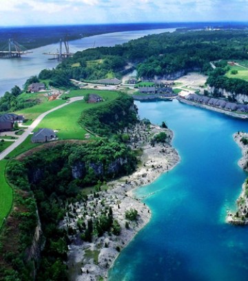
Surveys &
Mapping
Greater versatility.
Mining
Production & Safety
Real-time assessments.
Envirnomental
& Agriculture
Accuracy of GPS location.
Our Services
We offer a broad range of aerial imaging services.
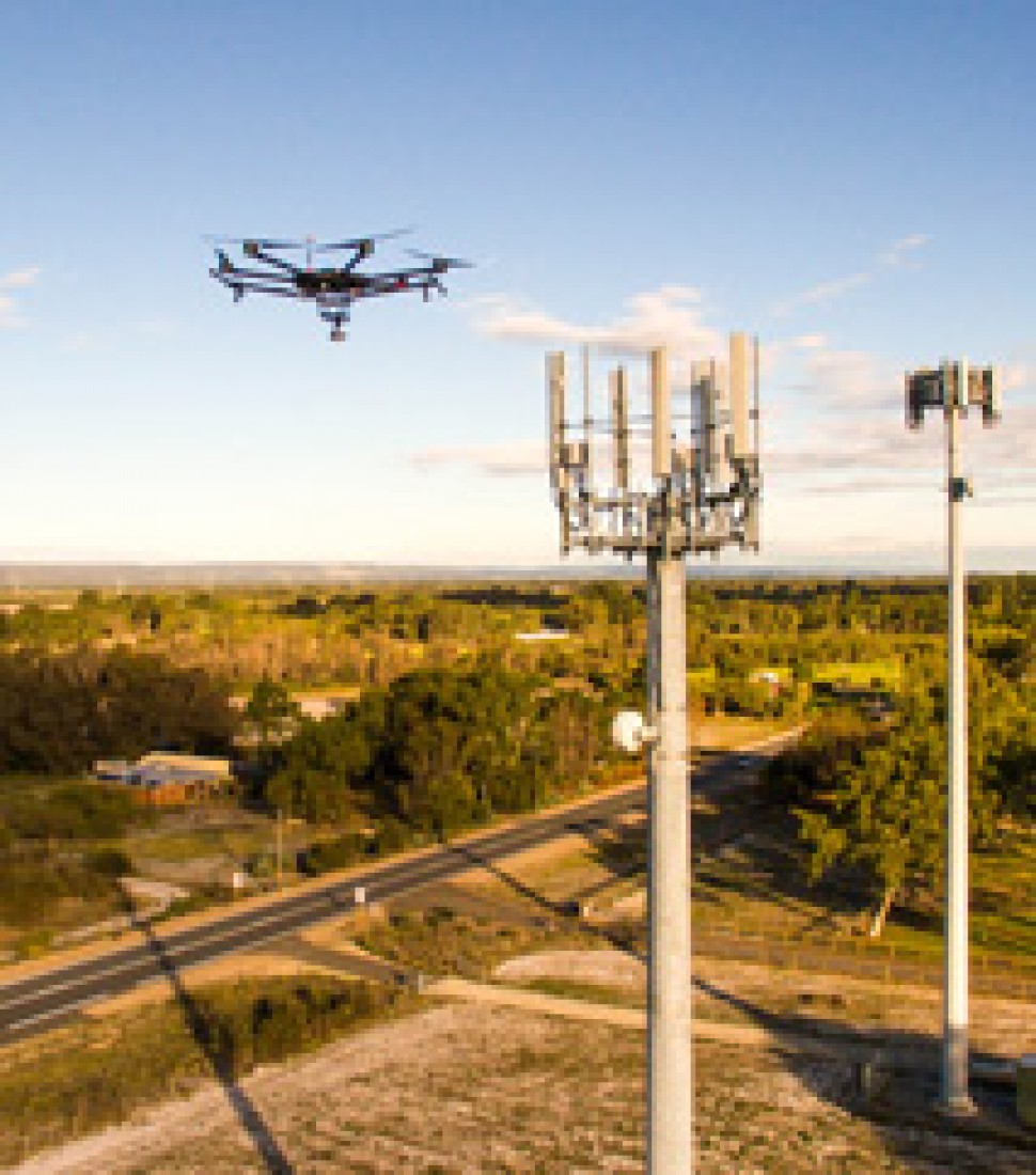
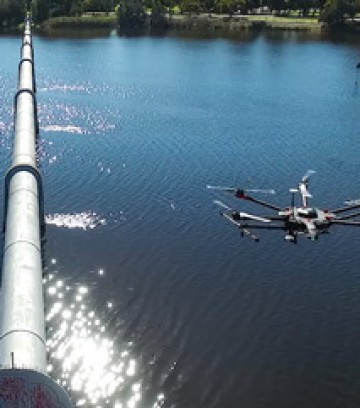
Aerial Inspections
- Assets
- Maintenance
Once the domain of expensive helicopter services, risky rope access or cherrypickers, aerial asset inspections are now delivered faster, safer and with far less expense as a result of Pegasus Drone Imaging services.
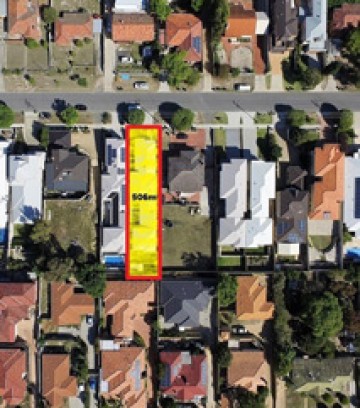
Real Estate
- Sales
- Developments
Drone imagery has revolutionised the way in which Real Estate is presented and sold today, enabling access to everything from breathtaking vistas through to internal fly-throughs.
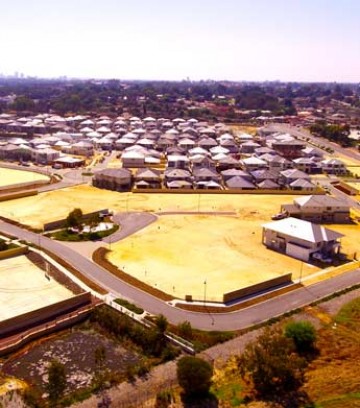
Land Development
- Earthworks
- Construction
Provide prospective clients and stakeholders with breathtaking aerial imagery of stages in the property development cycle, construction progress and easily visualise completion timelines.
Aerial Photography
- Video
- Stills
Available for a wide range of other applications including tourism, real estate, weddings, events, and corporate branding, PegasusDI provide top quality drone imagery to suit your requirements.
Surveys & Mapping
- Speed
- Simplified
Drones vastly reduce the time spent collecting accurate data, increase safety through improved risk mitigation, and lowers the cost of acquiring aerial data for all manner of mapping and surveys.
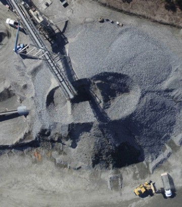
Mining
- Production
- Civil
Drones provide safer, easier, more cost-effective access to aerial observations, ore monitoring, stockpile measurements, vehicle/asset monitoring, and volumetric surveying for minesites.
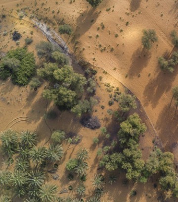
Environmental
- Safe
- Accurate
Comprehensive environmental monitoring and mapping services, with the provision of high resolution survey imagery and spatial solutions capable of delivering data for complex modelling.
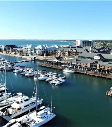
Marine Imagery
- Business
- Recreational
One of our specialties is marine imagery - be it video production for your marine business, capturing yacht races, or simply adding an extra unique element to your fishing charter.
PRICING OPTIONS
Pegasus Drone Imaging offers a broad range of services, competitively priced and professionally delivered.
Standard
6x edited still images . web qualityPremium
6x edited still images plus 1x 30sec edited videoweb qualityUltimate
10x edited still images3x 30sec edited videosweb qualityABOUT PEGASUS DRONE IMAGING
Origin
Pegasus Drone Imaging evolved from the successful WA consultancy ‘Brown Geotechnical’ following their use of drones for inspections and supervision in construction and residential developments.
Concept
Clients impressed with the quality and versatility of the drone imagery increasingly requested imagery for their websites, real estate sales and for asset inspections. Pegasus Drone Imaging was born!
Launch
Certification for the new business by the Civil Aviation Safety Authority (CASA) their Remote Operators Certificate (ReOC) was issued. With CASA licensed pilots and the required insurance, Pegasus DI ‘took off’ in early 2017.
FAQs About Flying Drones
What you can and cannot do with a drone.
Can you fly within 5.5km of an airport?
NO. But Pegasus can! Our ReOC allows for application to CASA to operate with airport controlled zones.
Can you fly in approach or departure paths or movement areas of an airport?
No... But Pegasus Can. Our ReOC allows for application to CASA to operate with these areas.
Can you fly above beyond visual line of sight (BVLOS)?
No... But Pegasus Can. Our ReOC allows us to apply to CASA to operate BVLOS.
Can you fly above 400 feet (120m)?
No... But Pegasus Can. Our ReOC allows application to CASA to operate above 400 feet (120m)
Can you fly over water at that big sailing event?
Yes… you can, but it’s a risk. But we love a challenge!!
Can you fly your drone at night?
No... But Pegasus Can. We are already authorised by CASA to fly at night with the use of our hex drones.
Can you fly closer than 30m to a person?
No... But Pegasus Can. Our ReOC allows us to operate to within 15m following a briefing session and using our consent form.